A day trip


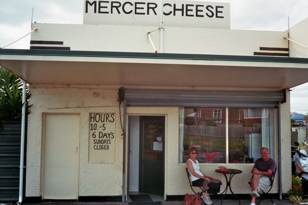
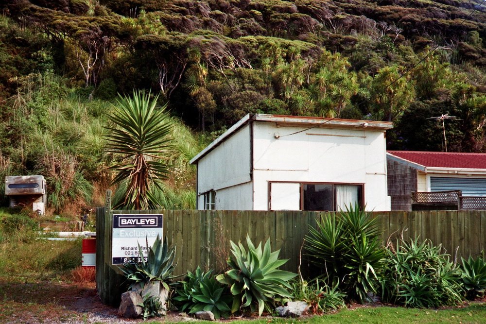
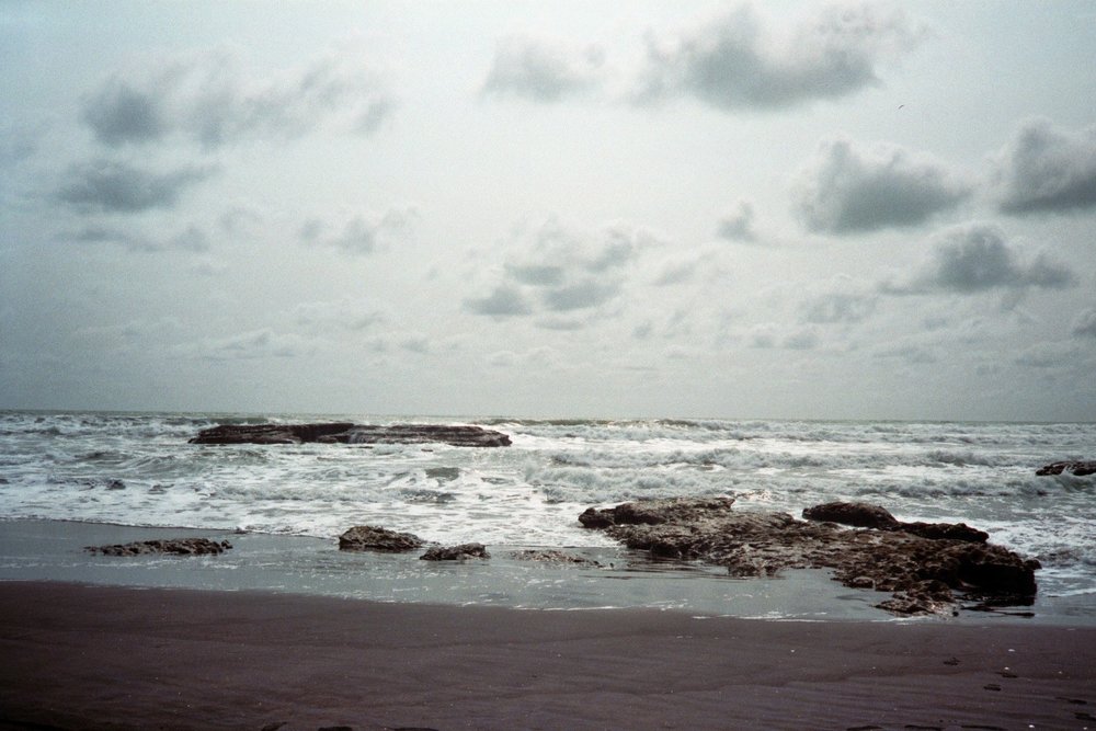
Boogie boarders in the surf at Port Waikato / tyre tracks in the black sand / Parents posing outside the Mercer Cheese shop / Tuakau Bridge, which leads to Port Waikato / a Bayleys exclusive property for sale / blurred Mercer cheeses / rough waters at Sunset Beach

While visiting New Zealand I generally limit myself to Auckland - apart from a week spent at the family beach house on the Whangaparaoa Peninsula (which is pretty much part of Auckland these days anyways) the main priority is to catch up with friends and family. However I do like to fit a day trip in at some point. Last time my parents and I motored northwards to Brick Bay Sculpture Park and the Scandrett Regional Park, both places I had never been to before, and both now with my seal of approval. This time I put forward the notion of heading in the opposite direction, as I never seem to venture southwards a great deal.

Driving south these days seems to take about half the time it used to, and the smooth sheen of the motorways  detract a little from the sense of adventure (as adventurous as one can be, when your parents are sitting in the front seats chauffeuring you), but as long as you take some pit stops along the way, you feel like you are off the main drag a bit, even if technically you are not out of Auckland.
We stopped in Mercer, to buy some Mercer Cheese, one of those small towns where they are all known for something. I wish we had also stopped in Pokeno, for some Pokeno Bacon. We nibbled on our mature Gouda with slices of apple as we took a scenic route of our own invention towards Port Waikato, the small settlement on the West Coast which is the mouth of the Waikato River, New Zealand's longest.

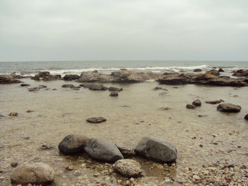
Port Waikato doesn't have any of the glamour of Piha, Bethells, or Muriwai. It's decrepit, the houses falling apart, single storied, single roomed, they all seem hunched over, sheltering themselves against the stiff breezes that pound them with salt. The surf beach goes by the rather misleading name of 'Sunset Beach', perhaps trying to trick innocent tourists into thinking it's New Zealand's answer to Home and Away's Summer Bay. But it is so unspoilt, and it's bleakness is to it's benefit. The beach was empty except for a few boogie boarders and perhaps a dog, and the surf lifesavers camped between the flags sitting in their buggy.
An overcast day, one could just stand on the beach at look out to sea, and see nothing.
I stared out into the distance as the clouds and surf spray merged with the sand dunes at the end of the spit which curves around into the mouth of the river. Apparently there is a walk you can do around there, and in the springtime sightings of dolphins and seals are possible.

We stopped at the local café/restaurant/takeaways (it was maybe the only shop at the beach, there was a sort of general store by the old wharf) and in a fit of New Zealand patriotism indulged in an L&P and a Hokey Pokey ice cream. We drove around the streets before leaving, I think I noticed a library, half the houses seemed to be for sale. If anyone wants to join me in setting up an art commune there, pretty sure we could buy the properties on the cheap.

On the return trip we crossed the Tuakau Bridge which spans the Waikato River, stopping for mandatory photo documentation. Built in 1933, in a way it served as the 'bridge' (what other word can I use) between the 'island time' of Port Waikato and the pounding repetition of everyday life.


Back To You

Claire has recently departed after an amazing two weeks in Scandinavia. Based in Malmö (where I currently reside) but also featuring a 4-day visit to Stockholm and a couple of day trips (perhaps night trips would be a more fitting phrase) to Copenhagen and its surrounds. In due course of our travels many photos were taken. With me equipped with a trusty point-and-shoot Konica film camera, and Claire with her Canon digital camera as well as her (smart) phone, we were armed to the hilt.
On looking through the accumulated snaps, a certain trend became rather apparent. And what was meant as documentation of two friends exploring three cities, ended up looking like Claire just followed me around in a rather stalkerish manner - a generous chunk of the images are of my back, or me in various stages or turning around. Perhaps there is now enough material for a 'Florence strides forth' tumblr or some such lunacy. But here let's keep things to only the choicest cuts.
My photos are due to be collected next week,and should hopefully even out the disproportionate number of Claire stalking Florence photos.

All photos by Claire Cooper.

PLACES: Drottningholm / Copenhagen / Drottningholm / Frederiksborg  / Stockholm / Frederiksborg /


Kinder's Matakatia is just the same as mine


Kotanui, Monsieur Direy's House, Whangaparaoa, 1868 / Cliffs, Whangaparaoa, near Auckland, 1868 / Kotanui Rock, Frenchman's cap, Whangaparaoa, 1868 /
via The University of Otago Library's Digital Collections

Photographs by the Reverend Dr John Kinder of Matakatia Bay and Kotanui Rock in 1868. It never ceases to amaze me that these cliffs and rocks are nearly exactly the same today as they were then. In fact I was sitting at the base of that cliff just a few months ago. My only observation is that Kotanui's hairline is receding a bit these days.

And that there appears to be a pair of disembodied legs posing at the island's base.

Great Scott


Three photographs taken by Robert F. Scott on his ultimately fatal expedition to Antarctica, racing the Norwegian Roald Amundson to the South Pole across the desolate and uncompromising, yet epic and sublime landscape. 

Scott was an amateur photographer taught the technical basics by the expeditions professional, Herbert Ponting, so Scott could document the final trudge to the Pole for scientific (and now, historic) purposes. A collection of Scott's photographs have recently been rediscovered and compiled into a book 'The Lose Photographs of Captain Scott' by David M. Wilson, incidentally the great-nephew of Dr Edward Wilson, member of the Terra Nova Expedition.

They make me feel an astonishing sense of loneliness and isolation that I have grown to associate with rocks, ice, islands and the colour white.

some brief descriptions of the above photographs, via The Guardian

1. Dr Edward Wilson sketching on the Beardmore Glacier, lunch camp, 13 December 1911

Wilson is seen here sitting quietly, sketching. He was one of the last artists in the great expedition tradition in which the pencil was the main method of making records. He produced many yards of accurate geographical drawings, as well as extensive notes and sketches of anything of scientific interest. Here he is drawing the mountain ranges along the Beardmore Glacier, from Mount Elizabeth (left) to the Socks Glacier and Mount Fox (right).
This panorama is the finest example of Scott's mastery of his camera, gained on the march in extreme conditions. The combination of action and repose – illustrative of Scott's unique pictorial understanding – encapsulates the contrast between the Antarctic's majesty and man's diminutive presence

2. Ponies on the march, 2 December 1911

As the pony column disappears into the distance, the "sledgeometer" on the final sledge clicking the mileage as it goes, the straggle of ponies becomes veiled in the icy wilderness. Many of the men in this image would return, but not all. None of the ponies would: within a few days they would be shot.

3. Camp under the Wild Mountains, 20 December 1911

Scott took this impressive image to capture the interesting geological features around Mount Wild. On the sledge in the camp, two figures can be seen sketching. On the left, Apsley Cherry Garrard is drawing the view towards Mount Buckley; on the right, Edward Wilson is making detailed sketches and notes of the geological features so clearly visible in Scott's photograph. The other figure that can be seen is probably Birdie Bowers, who died with Scott on their return from the polar expedition, just months later. Scott returned his camera to base with the First Supporting Party as they departed from the top of Beardmore Glacier towards Cape Evans. Critically, this lightened the sledge loads for the push across the Polar Plateau to the South Pole. Bowers, with his lighter camera, was chosen by Scott to become the photographer for the final pole party.


A lighthouse on a grey day


It was the only day which was overcast that we cycled out to Fårö's lighthouse. The road winds through a rather dense forest of tall pines, creating a closeness with the tall trees and the low sky, I think I forgot at some points that I was on my way to see a building which beckons travellers from the vast expanses of the open sea.

We stopped off en route by Fårö's only supermarket, purchasing a carton of milk from Gotland,  a couple of smoked flounder from the smokehouse nextdoor and a selection of freshly baked rolls from the nearby bakery for a small picnic on the beach.

Next to the smokehouse was a small flea market and book stall, in a rundown wooden shed with a dirt floor - piles of unsorted books piled on trestle tables, listing bookshelves and mildew afflicted cardboard banana boxes. I surprisingly found an english copy of Goldfinger amongst the mess, for 5kr.

The lighthouse was surrounded by a low wall and a small outcrop of buildings. One can't go up to the light house as the area inside the wall is private property. The greyness of the sky and sea was reflected in the lighthouse structure itself, as well as the grey rocks below it, but it wasn't that gloomy, depressive grey that low clouds usually bring. The entire scene and atmosphere suited the weather much more so, than the swimming pool blue coloured skies of the days prior.

After lunching we lay in the sand dunes, using our jerseys and cardigans as makeshift pillows, as adventurers are wont to do (or so I like to think), and dozed lightly. After a while I wandered down to the shoreline, and discovered a dead seal. Some sea creature had eaten it's eyes. I didn't take a photo of it.